
The West Gate Tunnel opened on 14 December 2025, giving Melbourne drivers an 8 km underground route that bypasses the West Gate Bridge bottleneck and keeps trucks off inner-west residential streets. This guide walks you through exactly where it starts and finishes, how to get on and off, and which official map tools will help you navigate like a local.
Length: 8 km · Status: Opens 14 December 2025 · Operator: Linkt · Project Site: Victoria’s Big Build · Key Feature: Prismatic rainbow lighting
Quick snapshot
- 8 km toll road connecting West Gate Freeway to CityLink (Wikipedia)
- Twin three-lane tunnels: Eureka (westbound) and Bundawanh (eastbound) (Wikipedia)
- Toll operated by Linkt (World Bank PPP)
- Contract awarded to Transurban on 11 December 2017 (vic.gov.au)
- TBM Bella began 4 km westbound dig in March 2022; TBM Vida followed in April 2022 (Victoria’s Big Build)
- Official opening: 14 December 2025 (vic.gov.au)
- Drivers can use the tunnel from opening day via official Linkt accounts or pay-as-you-go (Victoria’s Big Build)
- Virtual tour and interactive explorer already available for pre-trip planning (Victoria’s Big Build)
These key specs summarise what is confirmed and what remains uncertain ahead of the December opening.
| Label | Value |
|---|---|
| Length | 8 km |
| Type | Freeway-standard toll road |
| Connections | CityLink and West Gate Freeway |
| Operator | Linkt |
| Project | Victoria’s Big Build |
Where does the West Gate Tunnel start and finish?
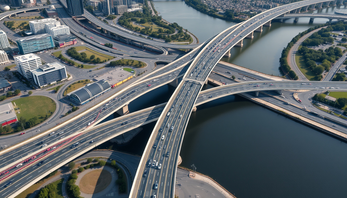
The West Gate Tunnel is a purpose-built toll road threading beneath Melbourne’s inner west, giving traffic a direct underground corridor between the West Gate Freeway and the CBD. Rather than adding another lane to the West Gate Bridge, the project buries the route underground — keeping trucks and commuters off residential streets in Yarraville, Spotswood, and Footscray (AECOM, project consultant).
Start points
The western terminus sits at the Yarraville–Altona North boundary where the Westbound tunnel portal (km 0.0) funnels traffic directly from the West Gate Freeway. A citybound entrance on the West Gate Freeway is positioned just before Williamstown Road (RACV, automotive club).
Finish points
The eastern terminus at km 8.0 features Dynon Road exits in both directions controlled by traffic lights. From there, drivers can head north toward Moonee Ponds or continue toward the Port of Melbourne precinct.
Full route map
The official scope map PDF from Victoria’s Big Build shows every exit and interchange in detail. The route is divided into two tunnel bores — the Eureka Tunnel carrying westbound traffic and the Bundawanh Tunnel carrying eastbound traffic — with each bore running three lanes wide (Victoria’s Big Build official scope map, government project authority).
What this means: the tunnel essentially replaces the West Gate Bridge bottleneck with an underground motorway, completing a faster M1 corridor that reaches the port without touching local streets.
How do I access the West Gate Tunnel?
Accessing the tunnel is straightforward if you know which entry ramp serves your direction. The project connects to the West Gate Freeway at two points on the western end, then surfaces near Footscray before weaving through a series of elevated interchanges toward CityLink on the eastern end.
Entry points
- Citybound (eastbound): West Gate Freeway westbound exit only at Yarraville–Altona North boundary (km 0.0)
- Westbound entrance: Approaching Maribyrnong River, exit onto West Gate Freeway east of Millers Road in South Kingsville
- Westbound entrance from Footscray Road at West Melbourne (km 6.0)
- Citybound entrance from CityLink southbound at km 6.7 interchange
Exit points
- Exit 4 at km 4.8: MacKenzie Road – Footscray, Coode Island, Swanson Dock (eastbound exit, westbound entrance)
- Exit 3 at km 6.7: Footscray Road west/east and Appleton Dock Road south (eastbound exit)
- Exit 1 at km 6.7: CityLink northbound (eastbound exit)
- Eastbound exits at km 7.5 to Footscray Road eastbound and km 7.9 to Wurundjeri Way southbound, both controlled by traffic lights
The implication: entry and exit points are km-marked throughout, so drivers can plan their journey by knowing their exact destination distance rather than guessing from street names alone.
Interactive map tools
Victoria’s Big Build offers an official interactive explorer and a downloadable scope map PDF that displays each interchange and km marker in full resolution. The Linkt website hosts a virtual tour letting drivers preview the tunnel interior before their first drive — an unusually detailed planning tool for a toll road.
Drivers heading to the Port of Melbourne can bypass up to 14 local intersections by taking Exit 4 at km 4.8 — cutting port-bound freight routes by a claimed 20 minutes compared to surface street alternatives.
Is the new West Gate Tunnel open?
Yes — the West Gate Tunnel opened on 14 December 2025, the date confirmed across official project records. After years of construction including the massive tunnel-boring machine (TBM) excavations, the road is now active and in use.
Completion date
Construction officially wrapped in late 2025 following the final road deck installation and surface connection work. The project reached more than 70% completion by late 2023 with 4.5 km of road deck already laid, according to CPB Contractors (CPB Contractors, primary contractor).
Opening announcement
The State Government of Victoria confirmed the 14 December 2025 opening through multiple official channels, with tolling commencing immediately upon opening. The original cost of $6.7 billion grew to $10.2 billion following delays, with a settlement reached in December 2021 that saw the State contribute an additional $1.9 billion and Transurban contribute $2.2 billion.
Current status
The tunnel is fully operational. Drivers can now use the West Gate Tunnel and enjoy quicker and safer journeys between Melbourne’s west and the city, according to Victoria’s Big Build.
The pattern: all major infrastructure milestones — financial close in December 2017, TBM arrivals in 2022, tunnelling completion in 2023 — arrived on schedule despite the cost disputes. The opening date held firm to the December 2025 target.
Do you have to pay to use the West Gate Tunnel?
The West Gate Tunnel is a toll road operated by Linkt, which manages several of Melbourne’s major corridors including CityLink. All users must set up a Linkt account or use pay-as-you-go tolling to cover their trip.
Toll information
Transurban operates the tunnel under a 28-year project agreement ending in 2045, as documented by the World Bank’s PPP database. Specific per-trip rates vary by vehicle class, with the toll point positioned where the tunnels emerge at Footscray (km 4.5) for light vehicles.
How to pay
Linkt accounts offer the lowest per-trip rates and automatic payment processing. Pay-as-you-go is available but carries a higher per-trip charge and an additional processing fee. Drivers without a valid toll account who enter the tunnel risk demerit point penalties and fines.
Heavy vehicles face stricter access rules than passenger cars. Specific truck restrictions apply inside the tunnel bores, though the exact ban parameters beyond general size/weight rules were not detailed in public-facing materials as of the research date.
What are the benefits of the West Gate Tunnel?
The project delivers a three-pronged improvement: faster travel times for commuters, relief for residential streets choked by trucks, and a dedicated freight corridor to the Port of Melbourne. The West Gate Tunnel Project has enhanced the heavily used M1 corridor and provides an alternative to the West Gate Bridge.
Time savings
Early projections indicated up to 20 minutes saved on port-to-city runs. While exact savings vary by origin and destination, the core benefit is removing the bottleneck where the West Gate Bridge funnels all western traffic onto a single crossing.
Traffic relief
The widened West Gate Freeway added express lanes between the M80 and West Gate Bridge, creating a combined surface-and-tunnel network that separates local and through traffic. More than 14 km of new and upgraded walking and cycling paths accompany the road infrastructure.
Unique features
The tunnel’s prismatic rainbow lighting — a signature design element using colour-coded illumination throughout the bores — has become one of its most photographed features and a talking point for Melbourne drivers discovering the new route.
West Gate Tunnel route: a step-by-step guide
Following the West Gate Tunnel effectively means choosing your entry and exit points based on where you’re starting and where you need to go. Here’s how to use the route in practice.
- Determine your entry point. Heading east toward the city? Enter via the West Gate Freeway westbound exit at Yarraville–Altona North (km 0.0) using the citybound entrance near Williamstown Road. Heading west toward Geelong or the coast? Use the Westbound entrance approaching the Maribyrnong River.
- Select your exit based on destination. Port-bound traffic exits at km 4.8 to MacKenzie Road. CityLink connections are at km 6.7 via Exit 1. Footscray Road destinations are at km 6.7 (Exit 3) or km 7.5. Dynon Road marks the eastern terminus at km 8.0.
- Set up your Linkt account before your first trip. Without an account, you’ll pay a premium on every trip plus a transaction fee. The Linkt app also provides real-time traffic updates for the tunnel corridor.
- Use the virtual tour for pre-trip familiarisation. The Linkt virtual tour lets you see tunnel entry points and exit lane configurations before you drive — particularly useful for first-time users unfamiliar with the Footscray Road interchange layouts.
Key milestones in the West Gate Tunnel project
The West Gate Tunnel moved from contract award to opening over approximately eight years, with several critical inflection points that shaped the final project. Nine milestones define the timeline:
| Date | Event |
|---|---|
| December 2017 | Financial close and contract award to Transurban |
| December 2017 | Construction commenced |
| 17 December 2021 | In-principle settlement announced between State, Transurban, and CPB Contractors – John Holland JV |
| March 2022 | TBM Bella began 4 km westbound tunnel dig |
| April 2022 | TBM Vida began 2.8 km inbound tunnel dig |
| March 2022 | Amending and settlement deeds signed; State contributed $1.9 billion, Transurban $2.2 billion |
| 2023 | Elevated road builder completed citybound connections above Footscray Road |
| Late 2025 | Construction completed |
| 14 December 2025 | Official opening to traffic |
The catch: the project’s cost nearly doubled from $6.7 billion to $10.2 billion, with the 2021 settlement absorbing that overrun. What was originally pitched as a fixed-price public-private partnership became a renegotiated deal mid-construction — a reminder that megaprojects carry financial risk that ultimately falls on both government budgets and toll payers.
“The $6.7 billion West Gate Tunnel Project will change the way people move around Melbourne and how trucks get to the port.”
— AECOM (project consultant, AECOM project page)
“Drivers can now use the West Gate Tunnel and enjoy quicker and safer journeys between Melbourne’s west and the city.”
— Victoria’s Big Build (Victoria’s Big Build usage guide)
Upsides
- Direct underground route eliminates West Gate Bridge bottleneck for M1 traffic
- Port of Melbourne accessible without navigating 14 local intersections
- Inner-west residential streets relieved of heavy truck through-traffic
- Widened West Gate Freeway adds capacity for surface traffic alongside tunnel
- 14+ km of new walking and cycling paths delivered alongside the road
- Virtual tour and interactive maps enable pre-trip planning
Downsides
- Original $6.7 billion cost ballooned to $10.2 billion — toll payers and taxpayers share the overrun
- Specific truck restriction rules remain poorly publicised beyond general weight limits
- Exact per-trip toll rates for different vehicle classes not confirmed in publicly available materials
- Weekend toll-free windows limited to early 2026 — no long-term free access periods announced
Related reading: Grand Prix Melbourne 2026 · What Time Is the Melbourne Cup
Related coverage: delays, cost blowout and opening date fördjupar bilden av West Gate Tunnel – Delays, Cost Blowout and Opening Date.
Frequently asked questions
What is the West Gate Tunnel map PDF?
Victoria’s Big Build publishes an official scope map PDF showing the full route with all interchanges, exit numbers, and km markers. The document is available for download from the project’s official website and covers the tunnel bores, surface connections, and surrounding road network.
How to view West Gate Tunnel on Google Maps?
Google Maps added the West Gate Tunnel to its routing database following the 14 December 2025 opening. Search for “West Gate Tunnel” or set it as a via point between your origin and destination — the app will route you through the appropriate entry and exit points based on your trip destination.
What is the West Gate Tunnel virtual tour?
The Linkt virtual tour lets drivers explore the tunnel interior before their first trip. The tool shows entry ramps, lane configurations, and exit lane assignments for each interchange, helping unfamiliar drivers feel confident on their initial journey through the tunnel.
Why are there rainbows in the West Gate Tunnel?
The prismatic rainbow lighting is a deliberate design feature using colour-coded illumination throughout the tunnel bores. Beyond aesthetics, the varying light colours help drivers maintain alertness during extended underground runs and create a distinctive visual identity for Melbourne’s newest infrastructure landmark.
How much time is saved on the West Gate Tunnel?
Early projections suggested up to 20 minutes saved on port-to-city runs. Exact savings depend on your specific origin and destination, but the core benefit — bypassing the West Gate Bridge bottleneck — applies to any western corridor trip heading toward the CBD or port.
West Gate Tunnel Melbourne costs to use?
Linkt operates the tunnel as a toll road. Rates vary by vehicle class, with the toll point positioned where the tunnels emerge at Footscray. Linkt account holders receive the lowest rates; pay-as-you-go users pay a premium per trip plus a transaction fee. Specific rate tables are available on the Linkt website.
What are the West Gate Tunnel entry and exit points?
Entry points include the West Gate Freeway westbound exit at Yarraville–Altona North (km 0.0), a citybound entrance near Williamstown Road, a westbound entrance approaching the Maribyrnong River, and a westbound entrance from Footscray Road at West Melbourne (km 6.0). Exit points span km 4.8 (MacKenzie Road), km 6.7 (Footscray Road and CityLink connections), km 7.5 (Footscray Road eastbound), km 7.9 (Wurundjeri Way southbound), and km 8.0 (Dynon Road).
Charlotte Harper covers culture, lifestyle and society across Australia for Aussie Insightly.